 PZ Manual
Select Riverside on the B42 map and choose either a town errand or an outlying industrial trip. Search the landmark or use a POI category, inspect the road connection, and save a return point. River access is a separate check: proximity to the river does not prove a usable approach or safe drinking water.
Source review is not a game test or a guarantee for every patch, operating system or mod list. Record your exact game/server patch and relevant mods, then compare the author or official instructions linked below.
Orient the map before choosing a stop
Riverside is associated with the Ohio River in the town reference. Use the riverbank and road pattern to orient the view, then locate your actual start rather than assuming a default spawn. The older description is not a reason to call it the westernmost town in the expanded B42 world.
- Open ZomboidMap and select Riverside. Read the displayed build, then zoom until roads and building footprints are clear.
- For a town errand, enable only the matching POIs: Library & books, Hardware, Medical or Grocery. Search by landmark name if several markers share a category.
- For a vehicle or workshop trip, inspect Industry or Mechanic and the road connection from town. If planning a fuel stop, check the Gas pump object layer as well as the station marker.
- Inspect the selected floor and save the destination together with a nearby junction. Keep the operator URL/build with your note.
Source: Open ZomboidMap · town and resource search · Independent map operator · displayed Build 42.20
Source: PZwiki · Riverside · Community wiki snapshot · 42.12.3 label
Match the destination to the trip
The gallery landmarks are orientation leads. Keep them separate from named supply stops in the dated wiki. No exact Riverside POI coordinate or current stock was independently verified.
| Trip / lead | Source status / layer | Confirm or abort before committing |
|---|---|---|
| Town supplies: Enigma Books, Nails & Nuts, Pharmahug | Wiki labelled 42.12.3; Library & books, Hardware or Medical search leads. | Confirm the same block, floor and entrance. Switch to fallback if the name/layout differs. |
| Food: GigaMart or Grocery marker | Dated wiki name / Grocery category; stock unknown. | Confirm the approach and return junction; inspect remaining stock only on arrival. |
| Industry: Lectromax, U-Store It, Al’s Auto Shop | Dated wiki leads; Industry/Mechanic and Gas pumps serve different tasks. | Confirm continuous road connection and the actual needed object; abort if access or vehicle condition invalidates the plan. |
| Residential: school or gated area | Dated wiki leads; inspect outlines and access points. | Confirm an entrance and exit before treating a fence as shelter. |
| Orientation: Sunset Bar / Art gallery | Official 42.20 gallery labels, not guaranteed supply destinations. | Match the gallery subject to the selected render and nearby roads; absence of a search label is not a loot verdict. |
| Riverbank access | Town reference / visible bank; close zoom and actual approach check. | Confirm street-to-bank access; abort that leg if blocked. Water safety remains a separate check. |
Source: PZwiki · Riverside · Community wiki snapshot · 42.12.3 label
Source: The Indie Stone · 42.20 comparison and town gallery · Official map update · 27 July 2026
Source: Open ZomboidMap · town and resource search · Independent map operator · displayed Build 42.20
Identify Sunset Bar and the Art gallery from the scene
The Sunset Bar scene has a red roof, visible Sunset sign and a waterside deck. On a Riverside render, match the building footprint and its relationship to the water before using it as an orientation point. A named bar is not automatically the supply objective for a tools or medicine trip.
The official Art gallery scene shows a pale-blue building, a fenced terrace and its road-facing side. Compare the outline and nearby street, then confirm that the selected marker is the named gallery rather than any similarly coloured building.
Use these town landmarks to orient a town errand. For an outlying industrial target, zoom back out and trace that separate road connection; the gallery images do not prove a route to the industrial area. Keep the actual access result beside the destination, not an assumed stock list.
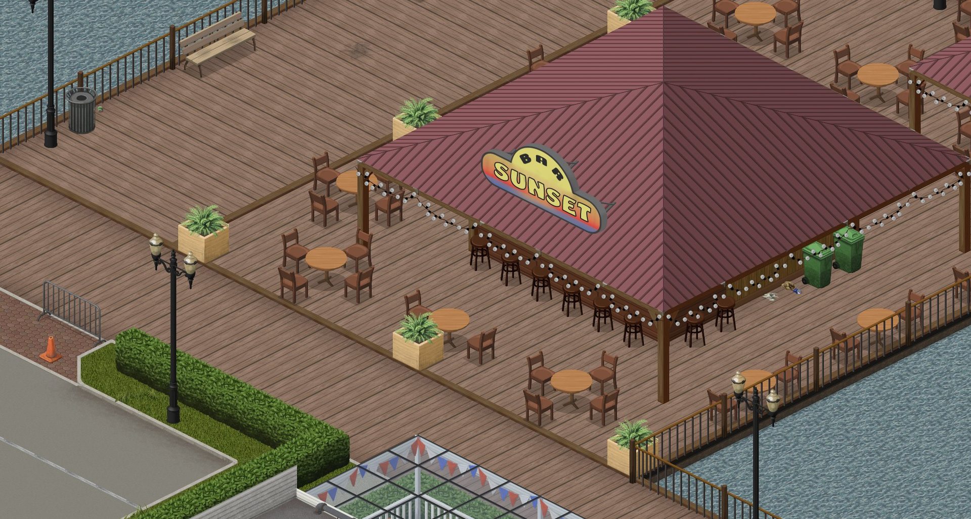
Sunset Bar, Riverside: compare the roof, sign and waterside deck with your selected render before using the building as an orientation point.
© The Indie Stone · Official Build 42.20 screenshot · 42.20: The Big Glow Up
Open the larger image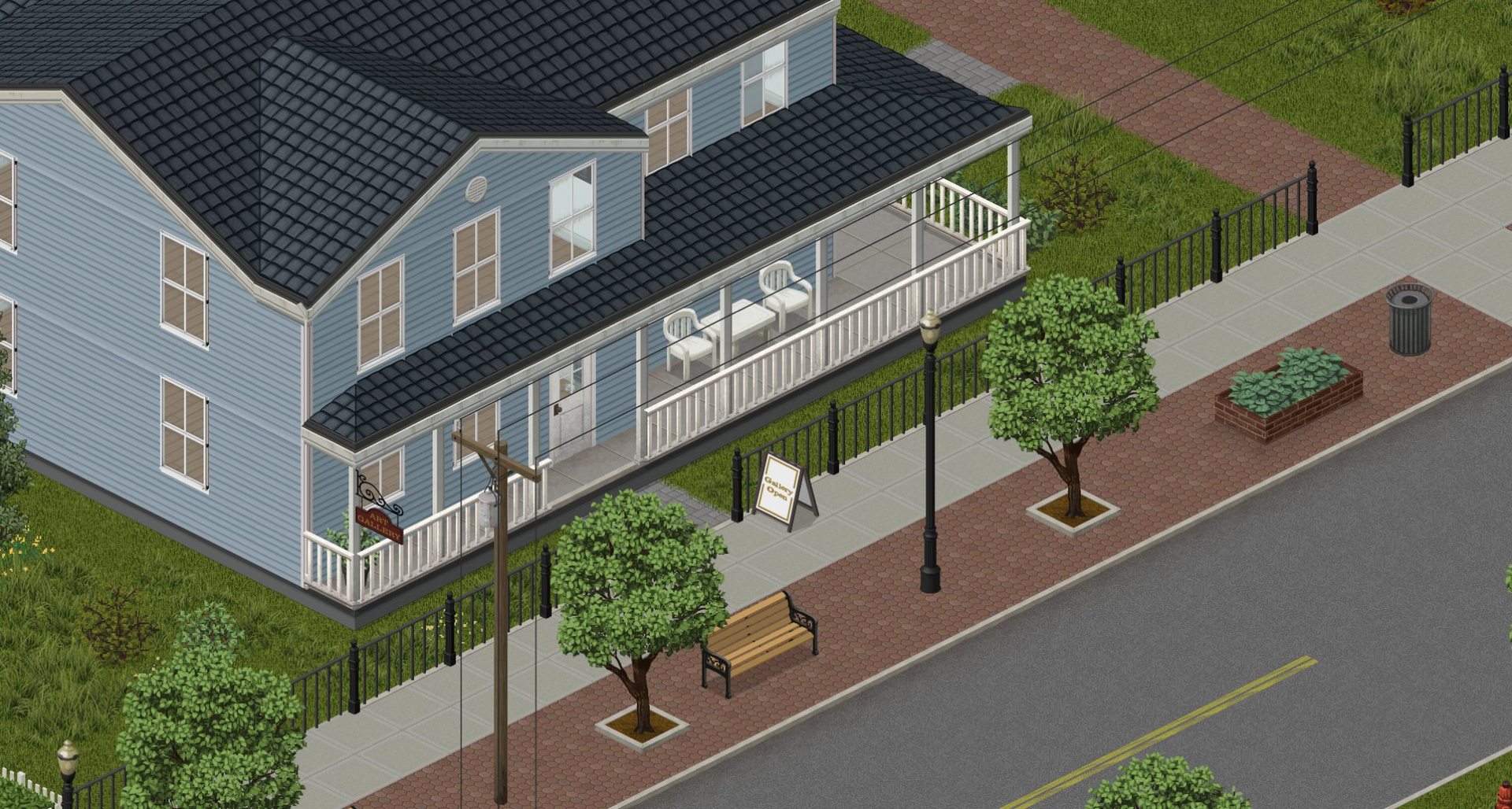
Art gallery, Riverside: use the building outline, terrace and road-facing side to compare a named destination; visual similarity alone is insufficient.
© The Indie Stone · Official Build 42.20 screenshot · 42.20: The Big Glow Up
Open the larger imageSource: The Indie Stone · 42.20 comparison and town gallery · Official map update · 27 July 2026
Plan a town errand with a return option
- Select one primary town stop and one fallback in the same part of the rendered town. Start with the need you are trying to meet, not a list of every business.
- Trace the approach along roads and check a parallel or returning route. Choose a visible junction where you can decide whether to continue.
- At the destination, compare the actual entrance and surroundings with the map before entering. If the block is unsuitable, go to the fallback or return; do not assume a map danger overlay sees your current situation.
- Record the destination you actually visited and what remains unsearched. This makes the next trip plan about observed progress rather than an old guide’s loot claim.
Prepare an outlying industrial trip separately
- Locate the industrial destination by name or category, then zoom out until both it and your starting area are visible. Confirm a continuous road connection rather than drawing a straight line through fields.
- Choose a return point before the target and inspect any detour that would be needed if the final approach is blocked. Keep your return supply and vehicle condition in mind when deciding how much of the trip to attempt.
- Separate resource-marker checks: a mechanic icon, a storage building and a fuel pump describe different opportunities. Do not assume they provide the same supplies.
- After arrival, mark only the portion you have actually checked. If the map and game disagree, preserve the version/mod details for the next comparison.
Copy a Riverside trip worksheet
Riverside trip worksheet
Trip type: town / industry / river access
Map URL / displayed build:
Game patch / map mods / world age:
Units: Tile / Chunk / Cell / unknown; floor:
Actual start / departure road:
Primary objective / name or category:
Required layer: POI / Industry / Mechanic / Gas pumps / bank view
Fallback / return junction:
Continuous road or bank approach to confirm:
Abort or return condition:
Actual access / object / supplies observed:
Water safety checked separately (if relevant):
Use one trip type at a time. Fill in actual observations; the map does not report your save’s current access or supplies.
Source: Open ZomboidMap · town and resource search · Independent map operator · displayed Build 42.20
Check river access and useful-object layers
If the goal is water access, inspect the bank connection from your chosen street at a close zoom. An overhead view can help choose where to investigate; it cannot confirm that every point is reachable or that carried water is safe to drink. Use the water guide when the fluid remains tainted.
For a well, oven or fuel pump, select the relevant Survival finds filter and verify the object in game. Turn off unrelated layers if icons obscure the route. Do not confuse a missing label with a complete survey showing that the resource does not exist.
Source: Open ZomboidMap · town and resource search · Independent map operator · displayed Build 42.20
Choose the next branch
Sources & verification
These guides compare public map interfaces and attributed reference material. PZ Manual has not run a game route, surveyed current loot or verified the map against a local 42.21 installation. Route choices and recording checklists are original editorial advice.
- Open ZomboidMap · town and resource searchInterface rechecked 13 October 2026: displayed Build 42.20, Rosewood/Riverside town entries, Fire Dept/Police/Hardware/Grocery/Medical POIs, Wells/Gas pumps filters, right-click coordinate copying and [ / ] floor controls. Rosewood search became stuck/timed out; no exact POI coordinates or share link were verified. Independent fan-made map; exact 42.21 tile coverage, save state and routes remain untested.
- PZwiki · RiversideRead 12 October 2026. Retrieved page labels 42.12.3 and requests a Build 42 location-refresh review. Used for town and landmark names only; not as a current 42.21 coordinate, loot or safe-route database.
- The Indie Stone · 42.20 comparison and town galleryReviewed 13 October 2026. Official comparison says Build 42 doubled surface area and identifies western additions Brandenburg, Ekron and Irvington. The 42.20 gallery separately labels Rosewood downtown / Kentucky State Penitentiary and Riverside Sunset Bar / Art gallery. Images are orientation references, not exact current-game coordinates or loot evidence; no square-kilometre total is supplied.